
HVAC & Rooftop Units
Hotels, healthcare buildings, and visitor properties can have tight street access. Public control and emergency routes must remain workable throughout the placement.
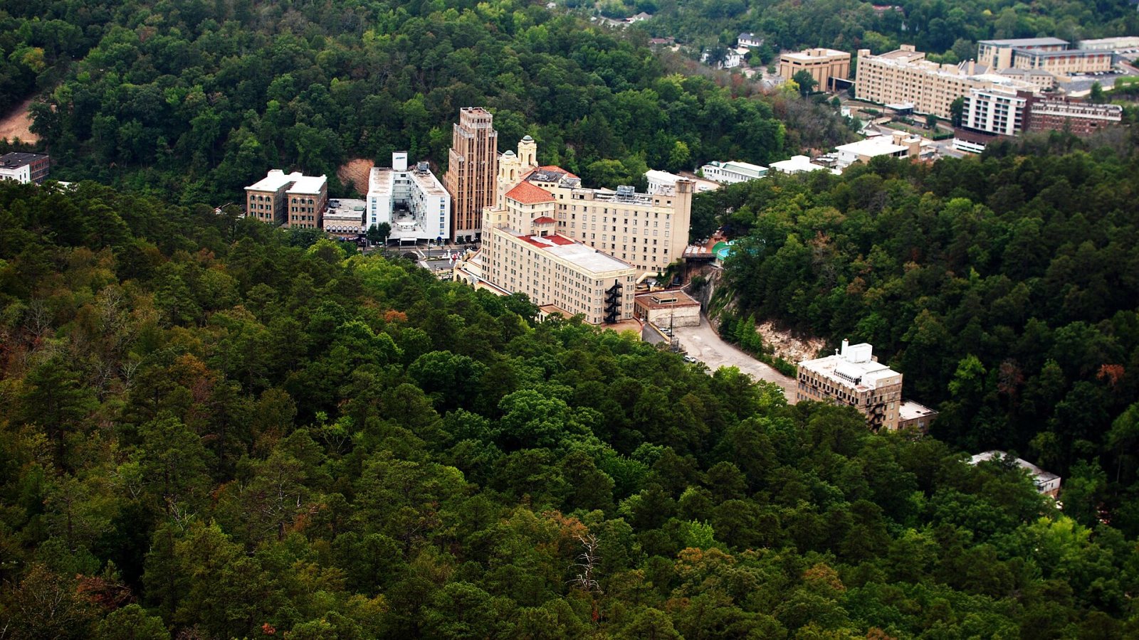
Local lift planning
Ouachita ridges press visitor, healthcare, and utility sites into narrow ground where obstacles and runoff can control the entire access plan.
Hot Springs is built into the Ouachita Mountains. The National Park Service geodiversity atlas describes steep, forested east-west ridges divided by narrow valleys. The Arkansas Geological Survey landslide guidance documents rock walls approaching 100 feet in central Hot Springs and a local history of rockslides and landslides. A straight-line route can cross wooded slope, exposed rock, or a street with no practical crane setup.
Hot Springs Memorial Field is three miles southwest of the city at 540 feet above sea level. The July 9, 2026 FAA Chart Supplement entry lists two runways, published Class E service hours with Class G at other times, and trees or poles near several runway ends. The airport is non-towered, but that does not make nearby off-airport work simple. Traffic awareness, current airport information, obstacles, and the exact flight path still matter.
The city’s economy places major occupied properties inside that terrain. The Forward Hot Springs 2040 plan describes a regional center for healthcare, tourism, shopping, and entertainment while identifying infrastructure connectivity as a development priority. Rooftop equipment and municipal work may face limited street or slope access, but every aerial concept still needs a ground-crane comparison.
Storm runoff can change the site after the flight plan is drafted. The NWS Little Rock 2023 summary records 3.13 inches of precipitation at Hot Springs during a flash-flood warning and later softball-size hail around Hot Springs and Lake Hamilton. Heavy rain can block low streets or weaken steep access ground, while hail and severe storms can end the work window outright.
The city’s Public Works department manages streets, drainage, floodplain rules, stormwater requirements, and inspection of work involving municipal right-of-way. Those ground approvals run beside FAA and Part 133 requirements, as outlined in the helicopter lift permitting guide.
A steep or lakeside site needs a usable load-preparation area, not merely an open set point. Wooded slopes can hide wires and limit escape paths. Rock cuts constrain truck turning, while runoff may remove the expected alternate route. The site survey checklist provides a field record for grades, obstacles, public boundaries, staging, and emergency access.
Hotels, healthcare buildings, and visitor properties can have tight street access. Public control and emergency routes must remain workable throughout the placement.

Ouachita ridges and wooded valleys can make utility access expensive. Slope, hidden wires, conductor control, and weather runoff require site-specific review.

Ridge sites may provide the needed coverage while limiting roads and staging. Existing obstacles and Memorial Field traffic belong in the route study.
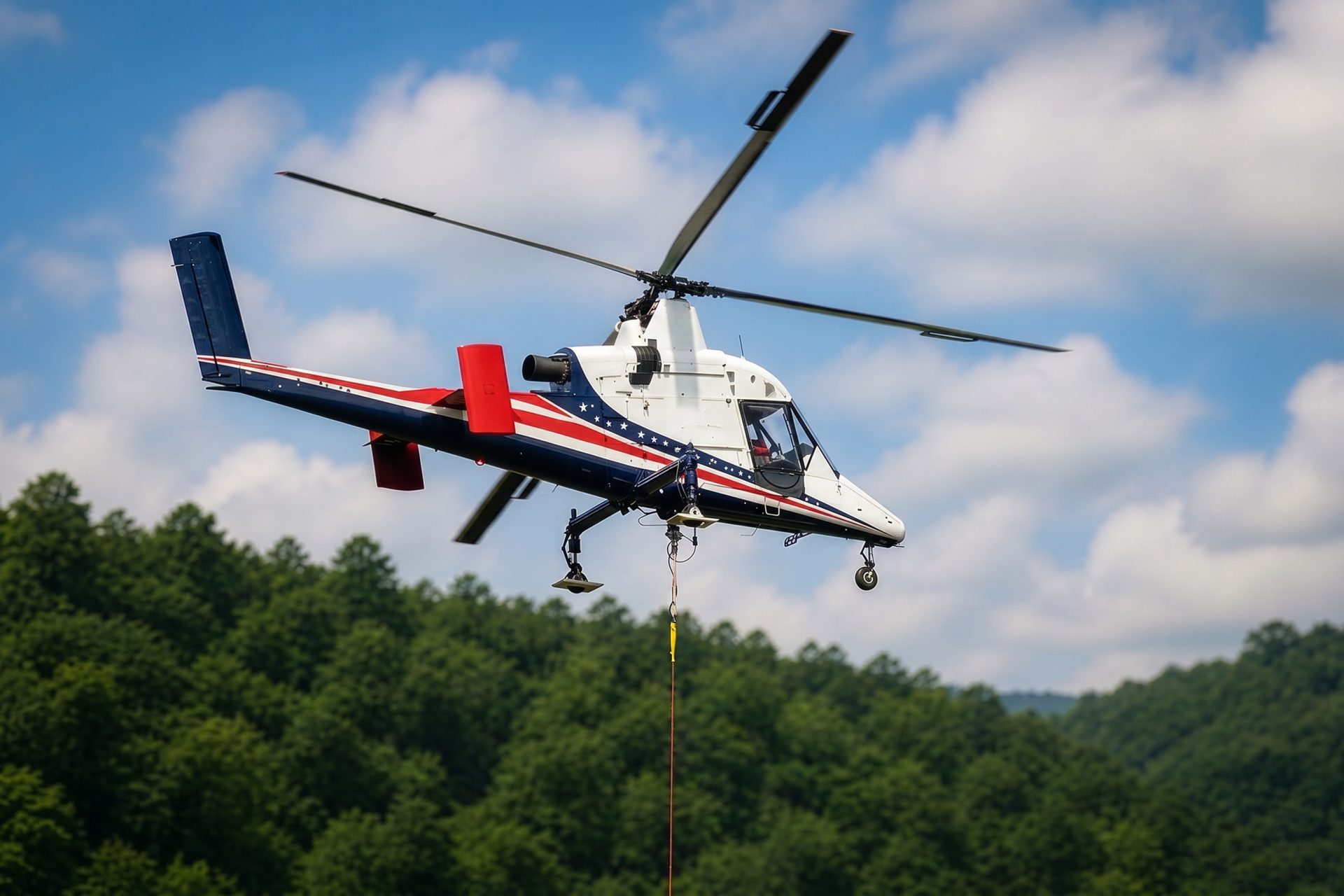
Lakeside or mountain sites can present short aerial-freight questions where building access would disturb steep ground. Verified weights and a secure staging area remain mandatory.

Flooding, hail, and severe storms can damage utility or public infrastructure and close normal routes. Recovery work still requires controlled ground areas and current aviation coordination.
Healthcare, hospitality, and visitor properties are central to the local plan. The city comprehensive plan identifies Hot Springs as a regional hub for those uses. Rooftop mechanical replacement can collide with occupied sidewalks, narrow streets, and emergency access, so the public-control plan may decide whether an external load is practical.
Utility, communication, drainage, and lakeside infrastructure extend across ridge-and-valley ground beyond downtown. Aerial placement can avoid cutting a temporary road into selected slopes, but obstacle clearance, load control, weather runoff, and the airport traffic picture remain hard constraints.