
Steel & Infrastructure
Waterfront structural work has to coexist with terminal activity and rail access. Aerial placement is only a candidate after the load, route, berth-side work area and exclusion zone are verified.

Local lift planning
The seaport and the hills sit in one city but pose different questions. Airspace and street access connect the two.
Photo: Martin Mbuthia, CC BY-SA 4.0, via Wikimedia Commons. Cropped, resized, rotated upright, and compressed under CC BY-SA 4.0. License terms.
The Port of Oakland strategic plan describes four container terminals and two intermodal rail facilities at the seaport. A placement near that waterfront would have to account for terminal activity, rail movement, the water edge, and people below the route. None of the plan's infrastructure needs is evidence of an approved helicopter project.
Oakland San Francisco Bay Airport adds a separate aviation question. The FAA flight-deck profile places OAK in Class C airspace beneath San Francisco Class B and describes a mixed-use airport with a 24-hour tower. Those facts make current airspace review essential. They do not make the airport an automatic staging point or establish a flight path to a worksite. The San Francisco city guide covers a different city across the bay; its airport context cannot stand in for OAK.
The Oakland Hills wildfire district has steep terrain, high-wind exposure and limited emergency access. That is a different site problem from the seaport. The site survey checklist helps keep slope, obstacles, ground control and access attached to the exact address rather than to a citywide assumption.
The FAA describes expected VFR transitions through OAK Class C, including routing near the runway and Oakland Coliseum for north-south traffic. Its airport guidance is orientation, not a standing clearance for external-load work. A proposed route requires current charts and air traffic coordination, including a NOTAM review. The congested-area planning guide addresses the separate ground-exposure review.
Weather must be matched to the site, especially where a route climbs into the hills. The NWS East Bay Hills zone notice defines a distinct forecast zone for Alameda and Contra Costa hill terrain at or above 1,000 feet because one broad zone masked local conditions. The City also describes hot, dry and windy periods in the Oakland Hills. A waterfront observation is not a substitute for the hill-site forecast.
The ground footprint can decide whether an urban approach works. Oakland's Obstruction Permit rules require a permit before blocking a lane, sidewalk or parking area. No-parking signs are posted 72 hours ahead; the City also identifies traffic-control-plan triggers for lane closures and detours. Those steps belong in the schedule before equipment or a load arrives.
Waterfront structural work has to coexist with terminal activity and rail access. Aerial placement is only a candidate after the load, route, berth-side work area and exclusion zone are verified.

A rooftop equipment move in built-up Oakland can turn on street occupancy and crane setup. The City permit path must be checked before treating a short flight as a simpler option.

A hilltop structure can be close on a map and difficult by road. Fire-weather exposure, terrain, ground access and controlled airspace all need exact-site review.
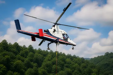
The eastern hills can limit vehicle access even within the city. Helicopter freight is a comparison case, not a substitute for verified loads, staging and emergency access.

Wildfire damage can constrain hill roads and work zones. Incident control and temporary flight restrictions govern any recovery scenario; the City's fire-risk map is not an operation approval.
The Port's 2025-2030 strategic plan identifies wharf upgrades and electrical-substation replacements as infrastructure needs. It does not specify a lift method. For any actual waterfront component, compare crane reach and ground occupancy with the flight route, rail clearances and terminal operating windows before choosing a method.
Oakland's hillside fire district also changes how an access problem is read. The Fire Department's WUI page documents steep terrain and limited emergency access, not a City helicopter program. A hillside utility or communications repair would need a site-specific load and exclusion area. For wider context, the California location guide shows why the state cannot be treated as one terrain type.