
HVAC & Rooftop Units
Downtown and waterfront roofs can make crane reach, street occupancy, and public separation the controlling constraints. Marine cloud and nearby airport traffic narrow the workable window.
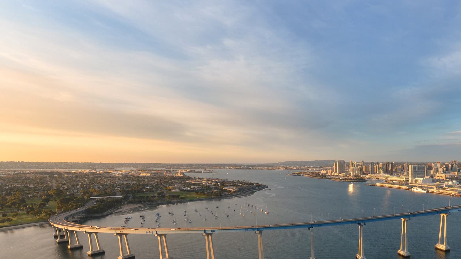
Local lift planning
Civil and military airspace overlap a coastal city cut by mesas and canyons, with marine cloud and port activity tightening the usable window.
Photo: Frank McKenna, CC0 1.0, via Wikimedia Commons. Cropped, resized, and compressed.
San Diego’s lift-planning map is also an airport map. The current FAA San Diego International entry lists one 9,401-by-200-foot runway and a published departure curfew. The Montgomery-Gibbs Executive entry separately identifies noise-sensitive areas. A downtown, port, or industrial lift concept therefore starts with current charts, NOTAMs, the proposed route, and a staging site the operator has actually accepted.
The working waterfront adds a different kind of constraint. The Port of San Diego cargo profile describes a 96-acre Tenth Avenue Marine Terminal and a 135-acre National City Marine Terminal with breakbulk and bulk handling, roll-on/roll-off cargo, on-dock rail, laydown space, and freeway connections. Those assets can support large components, but a flight path or set point may cross active marine, rail, roadway, or public boundaries that cannot be treated as empty space.
San Diego is a place where a helicopter-versus-crane comparison needs to be physical, not theoretical. Downtown roofs, shipyard-adjacent sites, mesas, and canyon edges can limit conventional setup. A helicopter can remove a road-building or crane-reach problem for a specific placement, but only after verified load weight, rigging geometry, approach and departure paths, and the ground exclusion area are reconciled.
Coastal weather can close an apparently good morning before the first pick. The NWS San Diego Weather Guide explains that marine-layer low clouds and fog are common near the coast, especially in late spring and early summer. It also describes Santa Ana winds as dry offshore flow that accelerates through passes and can bring damaging gusts and high fire danger. The plan needs weather gates for ceiling, visibility, wind, and fire conditions rather than a seasonal promise.
Heavy equipment reaching the site over city streets may carry its own operating window. San Diego’s transportation-permit rules cover oversized and overweight moves and restrict ordinary permitted travel during darkness, weekday peak periods, and visibility below 1,000 feet. Escort requirements also scale with width. Those ground rules do not replace FAA authority, but they can decide when a crane, aircraft, load, or support vehicle can occupy the site.
Montgomery-Gibbs cannot be assumed as a heavy-lift staging base because it is close to the job. The FAA supplement requires prior permission for helicopters above 6,000 pounds maximum takeoff weight to land at mid-port and documents nearby noise-sensitive areas. The site survey checklist should record an accepted staging location, fuel plan, public boundaries, obstacles, and alternate before the schedule is built around aircraft arrival.
Downtown and waterfront roofs can make crane reach, street occupancy, and public separation the controlling constraints. Marine cloud and nearby airport traffic narrow the workable window.

Port, shipyard-adjacent, and urban infrastructure sites can create short placements across active facilities where the ground-control plan deserves the same scrutiny as the load.

Mesas and developed ridges support communications infrastructure, but military and civil airspace, noise-sensitive areas, and canyon access all shape the route.
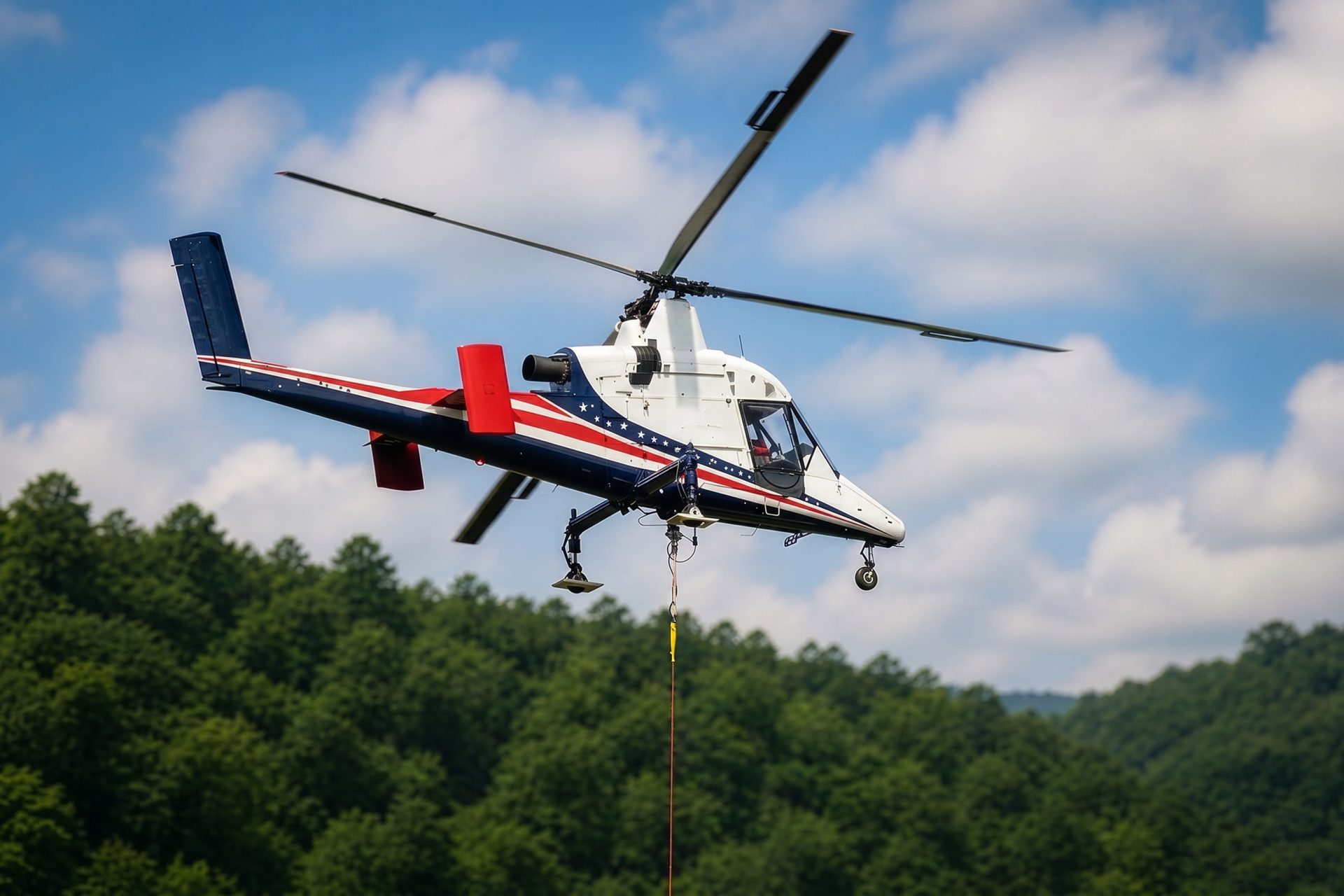
Backcountry sites east of the urban core can trade road construction for aerial access. Heat, Santa Ana wind, fire restrictions, fuel, and staging still control feasibility.

Wildfire and damaging wind can interrupt normal access. Recovery lifting still needs verified weights, controlled ground areas, current airspace coordination, and incident-command alignment.
The City of San Diego economic-development program identifies manufacturing and innovation, international trade and logistics, and defense among the city’s base sectors. Those sectors produce rooftop equipment, plant components, communications infrastructure, and constrained construction work. None of that makes an aerial method automatic. It makes verified loads and site access worth resolving early.
Marine terminals handle breakbulk cargo and vehicles, with rail, laydown, and freeway interfaces inside working facilities. The Port’s official cargo page provides the useful planning fact: the waterfront is an active logistics system, not an open staging field. Any lift concept near it has to protect vessel, rail, truck, worker, and public movement below the route.